Sunday,
2015-10-18
We
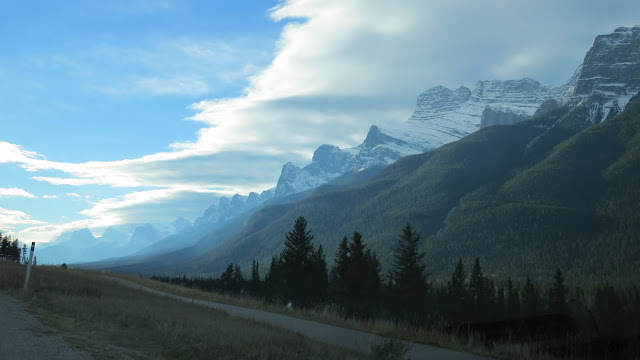
left home on Sunday at 9:30 in the morning. It was partly cloudy and
there were not too many cars on the road. Half an hour later, the
majestic view of the Rocky started to fill our sight. The most
striking peaks were to the south of Hwy 1, and were in Kananaska
country. In front of the peaks were the rolling foothills of the
Rocky and the farm lands(IMG_1313).

The poplar trees on the hills had
shaken their leaves, and we saw only the ghost like colour of the
woods. We saw a lonely cyclist on the road. His bike was loaded with
panniers and large bags. He must be on a long tour (IMG_1319).


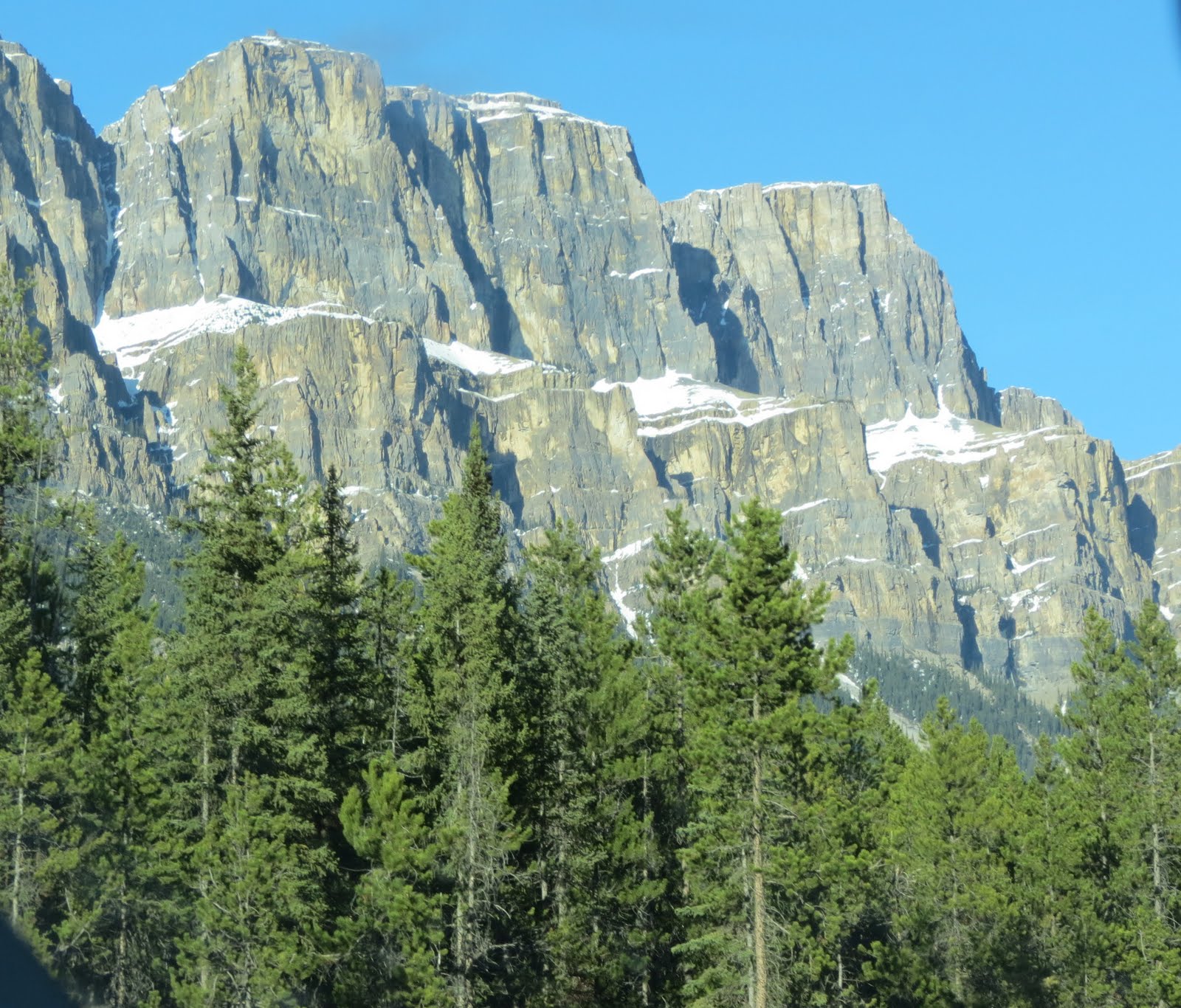
Dark
and heavy clouds were at the edge of the Rocky, and it dragged its
tail which was descended as a rain cloud into a valley north of Mt
Yamnuska (2240 m) in Fairholm Range (IMG_1326). This mountain had
been renamed in 1961 as Mt John Laurie. The face of this mountain was
light gray blue with some patches of light beige in colour. I
wondered if the light beige colour indicated the face that was
recently exposed after the erosion and the light gray blue was due to
oxidation or some chemical changes after a long exposure. The
mountain was like a vertical wall and had the shape of the ventral of
a clam shell. The texture of the wall was very rough, and had many
vertical cracks. The feature of horizontal layering was not
noticeable. Talus reached the foot of the wall. Trees were grown
densely near the top of the talus which had been stabilized, and
those talus which were still active were bare (P1150326).

Originally,
I thought that the mountain was the result of upturning of a hard
layer, but I was wrong. According to books written by Ben Gadd on
Canadian Rockies, the rocks in the Rocky were mostly sedimentary, and
it could be divided into 4 layers according to its age. The oldest
one (at the bottom) was Ancient Sediments formed during early to
middle Paleozoic (1.7-1.4 billion), and made of argillite, mudstone
siltstone and limestone; next up was Old Clastic Unit formed during
Cryogenian to early Cambrian (850-513 million), and made of slate,
gritstone and quartzite; next up was Middle Carbonate Unit formed
during middle Cambrian to Permian (513-251 million), and made of
limestone, dolostone and shale; the youngest layer on the top was
Young Clastic Unit formed during Mesozoic and Cenozoic (251-5
million), and made of sandstone, siltstone, shale, conglomerate and
coal. Each of these layers could be several kilometres thick. In the
following description of the layer formation, the data were taken
from the same references. The movement from southwest to northeast of
the continental crust along the west coast pushed these layer to move
in the same direction. Since these layers were not solid in
geological term, it folded and produced wrinkles. When pushed harder,
some of these wrinkles broke, and produced faults. As the push
continued the layers broke at faults would override the other layers
in front of it in the direction of the push and thus created
additional layers on top of the four layers. The erosion might
destroy part of these layers especially those additional layers that
had been turned up from its original horizontal orientation and made
them more vulnerable to the force of erosion. Furthermore, The front
limbs of these wrinkles were steeper than the rear limbs.

There was a wide light colour band of layer near the ridge (IMG_6128) and I wondered if this was the boundary between Middle Cambrian at the top and Devonian Unit at the bottom. The ridge then branched into north to Old Fort Peak () and into south to Loder Peak (2088 m) and terminated at the low Door Jamp Mtn (1996 m).

The shape of this last mountain bore its name. It seemed made of a successive thick layers of light gray colour rocks slabbed together at 45 degrees dipped westward to make its form. The western most layer was flat and covered densely by forest while the rest of the mountain was almost bare (IMG_6375), and its top had the clam like shape like Yamnuska. Trees grew densely on this side but very few on the rest of the mountain.

From a photo taken at the lookout on the shore of Lac des Arcs, one photo (P1110916) showed the repetitive layering of Middle Cambrian to Devonian Unit on the left, and then Banff Formation to its right, and Palliser Formation on the quarry.
Further
west, there were three major ridges ran from northwest to southwest
and all of them terminated at the northern side of Bow River Valley.
The most western ridge had a peak called Grotto Mtn (2706 m) located
at its southern end. The eastern side of this last ridge could be
seen clearly from the road and on the shore of Lac des Arcs
(IMG_6143).

This side of the mountain (facing east), its
slope was mostly covered by terracing, very steep and thick vertical
cliffs. Gadd pointed out that these cliffs were produced by the
broken off of rocks due to the lack of support. The band of these
cliffs remained almost horizontal and extended northward along the
ridge until they met at a valley form between the peak of Grotto
Mountain and another unknown peak to its east.

The band of layers
then turned around the valley floor and up to the unknown peak. The
layers were almost vertical at the unknown peak and were very rough
and twisted. It showed in detail the fine structure of the layers. It
seemed that the layers which were being pushed to move northeast
faced an obstruction (a fault?) and were being folded vertically
(IMG_3205). These layers belonged to Rundle formation, and underneath
it was the soft Banff formation, and near the top of Exshaw quarry
was the beginning of the hard Palliser formation. At the top of this
south going ridge, above the top of the light gray colour cliff, no
layer was shown, and the colour was turned into light rusty colour.
The ridge terminated at the south as a very prominent peak. The peak
was tall and massive and had a shape of a cone (IMG_1380).

Bow River
Valley as well as the highway turned from east-west direction into
northwest around the base of this peak. This gave us a good view of
this peak and the ridge. The slope of the peak had the same colour
and texture seen on the eastern side of the ridge. The terracing
feature of the cliff bands was seen more clearly as it covered the
cone shape end of this peak. The layering of the cliffs indicated
from southwest to northeast tilting.

At this end, the top of the
ridge became a broad butte sitting on top of the horizontal layers
underneath (IMG_3204). This top butte seemed to have three layers.
The top layer had many vertical cracks and no horizontal lines. The
middle layer was thin and lighter in colour, and had many fractures.
The bottom layer was thicker than the one on top and the colour was
the same as the top layer. Up to here, there was no major talus and
no large gullies were visible from the road. As the road turned
northwest, the west side of this ridge became clearly visible. The
slope on this side was gentler than that in the eastern slope, and
had more denser cover of forest to hide the layering feature.

However, the wide and steep gray colour bands were still clearly
shown in the photo (IMG_3199). The bare and smooth top with light
rusty colour became more obvious. At the top of this ridge, two large
funnels had developed, and the end of these funnels terminated at the
top of two separated giant and deep cracks opened up at the lower
part of this slope. These cracks revealed the detail texture of rocks
on this slope.


The crack went all the way to the foot of the slope
(IMG_3196, IMG_6325). The slope of the lower half of this ridge was
very gentle, and was covered by dense forest grew probably on talus.


On two photos (IMG_3070, IMG_3072) taken at the edge of this funnel,
they showed that the top of this ridge was actually also made of
layers folded over the top like a cap. Therefore, this top layers
might be an anticline of a fold. One of the photo also showed the
folding of the gray colour layers further down the slope indicating
that the funnel and the big crack below it was the result of a fault.
Therefore, the whole of this mountain or ridge was being folded, and
the top looked flat and lacked of layering simply because the rock
was harder. The photo also showed some vertical man-made structure at
the top. This will be investigated further on my next trip. Exshaw
cement factory had quarried the limestone at the foot of this
mountain and produced a big scar very easily visible from the road.
Turning
our attention to the south side of Bow River Valley. The first
mountain seen on the south side of Hwy 1 after entering the park was
not very significant. However, it had a very distinguish feature seen
from the other direction. It had a perfect low cone in shape. Its
slope was full of thick exposed rock bands tilting at 30 degrees from
north to south. Forrest filled the gaps between bands. The rocks had
the appearance like that seen in Door Jamp Mtn on the other side of
the valley (IMG_6374).

Next to it was a peak which had lost half of
its face by land slide (IMG_4971).

Further
west on the south side of the highway, there were three mountain
ranges running parallel from southwest to northeast where the
following mountains or peaks were located: Heart Mtn (2135 m), Mt
Mcgillivray (2697 m) and Mt Pigeon (). Heart Mtn was not high, but
was famous for the perfect heart shape ridge at its top. It was the
northern terminal of a mountain ridge running from Grant MacEvan Peak
at the south. The summit actually resemble a collar more than a heart
(IMG_6373).

And it could be decomposed into the east (left) and the
west limb around the top of the collar. Viewing from the front of
the mountain, there was a series of round and thick ridges west of
the western limb ran all the way to the base of the mountain. The top
of these ridges fell down on the shoulder of the mountain like the
folding of a robe. The first of these ridge was probably the border
of a fault line. The eastern limb connected with the western limb at
their bottom ends like a collar. To its east were another series of
parallel ridges which were terminated at the fault line. This side of
the mountain was very gentle and was covered by dense forest and the
layering of these parallel ridges was not very clearly shown
(P1150321). The whole mountain had the appearance of a
kimono robe. The west side view of the mountain showed that this side
of the mountain was made of many thick layers extending all the way
southward to Grant MacEvan Peak. It seemed that all these thick
layers west of the western limb were piling up against the fault
(P1150313).

The tops of these layers decreased in elevation in
orderly manner to clearly reveal the layering structure. This special
appearance of the mountain was not seen clearly from the road coming
from east, but the sight of this mountain would not be missed if one
was traveling in the opposite direction.
The
view of the massive and flat top McGillivray Ridge filled up the
view in front of the road after seeing Mt Yamnuska. The Ridge ran
from the Skogan Peak in the south to the shore of Lac des Arcs. At
the middle of this ridge was the broad, flat and low butte summit of
Mt McGillivray (IMG_6135). The pointy and tit like peak at the southern end (to the left) of the photo was probably Skogan Peak.

The slope of the ridge from this summit to
its foot near the road was rather gentle and had no interesting
features. The top 1/3 of the ridge was bare and light gray in colour,
and the rest was covered in dense forest.

The photos I had on this
mountain were all taken when the sun was behind and did not show it
very clearly. In one photo taken in January 2011 (IMG_6409) when the
mountain was covered under snows, it showed that higher up from the
tree line, there was a broad darker colour band running at 30 degrees
downward from south. This dark colour band was not visible from
photos taken in other season. This band was the thick and steep
cliff, and the forest further down was grown on the talus. The other side of this range was
not clearly visible from the road because the view was blocked by the
mountain range to its west.

Behind
it (further west) was another range only half the length of
McGillivray. The ridge on this range ran gently from south to its
summit at Mt Pigeon. It then had a large and deep cut on its eastern
side, and followed by a smaller cut facing north, and the last one
which was a large “L” shape cut with the top part facing west and
the lower part facing north with its foot at the side of the highway.
The view from east was partly blocked by McGrillivray Range, and we
saw only its top part which was dominated by a triangular shape
forest at the top of the big cut facing east (IMG_1357).
A photo
taken in January 2011 (IMG_6419) with snow cover revealed this large
cut had a rectangular outline on the top, and it could be due to rock
slide. The smaller cut facing north had no special feature.

Coming
from west from Canmore, one had an excellent view of the mountain
(IMG_6357).

This side of the mountain was flat like a roof like that of Mt Rundle in Banff. It was almost covered fully by dense forest. The large break at the southern end of the mountain revealed that the layering was light gray in colour and was tilting almost 45 degrees from west to east like the roof. The most prominent features was the terminal point of the ridge like a nose (IMG_3077).

In photos taken in 2012, 2013 and 2014, it clearly showed a weather station on top of this nose (IMG_3069), but the station was no longer seen on this trip. This face had many steep and deep cliffs.

The
valley and the road turned into northwest, and the valley became four
times wider. To the east, it was continually bounded by Fairholm
Range. All mountains on this range had the colour of light beige. Mt
Grotto was the first peak starting from the south. Further north, it
had Mt Lady McDonald (2606 m), Squaw's Tit ( 2514 m), Mt Charles
Steward (2809 m), Mt Peechee (2935 m), Mt Ingilmildie (2964 m) and Mt
Girouard (2995 m).

The top part of Mt Lady McDonald was bare and a rusty colour like the top of Grotto Mtn. Furthermore, its surface was full of scares from the broken off slabs. It also had a deep funnel at the summit which terminated at the top of a large crack like what we had seen in Grotto Mtn (IMG_6189).

This funnel was guided by five steep ridges of rocky out crops (DSC02191).


The next prominent peak was Squaw's Tit. It was not on the same ridge as Mt Lady Mcdonald, and was easily identified by the large rock on its summit which bore the name. It had two ridges facing the road, and they formed a wide valley between them. They had the appearance of the arms of a big armchair (IMG_1401). There were more trees on this mountain.

The rock forming the tit seemed to have layering structures appeared to spiral around it. There was also a significant vertical split or crack on this rock (IMG_3155).

On one photo (IMG_3151), it showed that the ridge where Squaw's Tit was found was formed by vertically fold layers. These layers were later polished or eroded away by glacier.

Next was Mt Charles Steward. On this side facing west, the mountain was bare of everything. It had a prominent ridge showing the piling of layers all the way to its top by folding (IMG_6332). Both sides of these layers had been seriously eroded to sharpen their tops into points. This folding was also clearly shown on the other ridges on these mountain. These three peaks were best seen from Canmore.
The
last three mountains on Fairholm Range were on the most northern end
of the range, and they were actually on another smaller range
separated from the main body of the range by a deep valley running
from southwest to northeast. And to the north and east was bounded by
Lake Minnewanka. The range was like a corner stone of the lake and
Bow Valley. All the mountains and peaks on this small range were on
the major ridge running from south to north.

From the south, the first one was Mt Peechee (2935 m). It was at the southern end of a rim surrounded a large cirque with Mt Girouard at the north. It was very rough which was left after the cirque was formed (P1150278). Its southern side also formed a large cirque with two unknown lower peaks at its east and south. This cirque was probably not yet fully developed and had the shape of a funnel with a very large broken off scar at the middle. This side showed a very complex of layering, and unfortunately was mostly covered by debris.

Under snow cover, however, the photo showed that from the top of the cirque up there were several levels of terraces of layers tilting from west to east. The terrace was then replaced by a smooth climb all the way to the pointy summit (IMG_3117).
There were four ridges branching out from Mt Girouard (2995 m), and they all formed a large cirque. The summit of this mountain had a special wedge shape peak, and on the ridge running southwest were several tall rock out crops and vertical cliff walls which were very easy to identify from the highway (IMG_1874).

The wedge shape peak was also very easy to see from Banff. The layers started from Mt Inglismildie, went around the large cirque formed between Mt Girouard and Mt Inglismildie in mild undulation, and extended all the way to the ridge in front of the summit where the large rock out crops was found. The higher layers on this ridge, near the foot of the summit, folded vertically up and form the wedge shape. The flat face of this wedge was probably the top of these layers (P1150275).

Further north on the major ridge was Mt Inglismildie (2964 m). The texture of the whole mountain consisted of horizontal layering (IMG_3101).

The other side of these two mountains could be seen from Lake Minnewanka, and they were very rough. All the four mountains on this small range had quite a difference appearance and were very rough compared to other mountains on Fairholm Range to the south.
To
the west of the road, there was the famous Three Sisters Range in the
south and Rundle Range to its north. Starting from the south, the
major ridge of Three Sisters Range had the following peaks: The
Rimwall (2684 m), The Big Sister (Faith Peak, 2936 m), Mt Lawrence
Grassi (2685 m), and Ha Ling Peak (2407 m). Another ridge branched
out from the Big Sister and ran northwest and produced the Middle
Sister (Charity, 2769 m) and terminated with the Little Sister (Hope,
2694 m). The colour of mountains on this range was light gray blue.
The Rimwall could be viewed from the highway after passing the
western end of Lac des Arcs (IMG_6178).

The tall and steep wall almost reached the summit. The wall could be divided into four sections. The bottom one was covered by dense forest, and was not clearly visible from road. There was a very light colour, and narrow horizontal band separating from its upper section. This second section also covered mostly by patchy forest, bands of steep wide cliffs, and bare smoothed face separated by vertical gullies. The bands of cliff in this section indicated the layers were tilting from southwest to northeast direction. The next section higher up was bordered by three line and the top edge of talus. The wall in this section was very rough with many vertical cracks. The roughness was caused by the broken off slabs, which also created scars on the face. But the layering feature remained the same as the lower section. The top most section was heavily covered by debris, but the layering was still noticeable all the way to the submit. There was a dent on the face of the pointy summit.

The tall and steep wall almost reached the summit. The wall could be divided into four sections. The bottom one was covered by dense forest, and was not clearly visible from road. There was a very light colour, and narrow horizontal band separating from its upper section. This second section also covered mostly by patchy forest, bands of steep wide cliffs, and bare smoothed face separated by vertical gullies. The bands of cliff in this section indicated the layers were tilting from southwest to northeast direction. The next section higher up was bordered by three line and the top edge of talus. The wall in this section was very rough with many vertical cracks. The roughness was caused by the broken off slabs, which also created scars on the face. But the layering feature remained the same as the lower section. The top most section was heavily covered by debris, but the layering was still noticeable all the way to the submit. There was a dent on the face of the pointy summit.
Further
up northwest on the main ridge was the Big Sister of the Tree
sisters. It was a very prominent peak seen from the eastern boundary
of Banff National Park (IMG_6161).

Photos taken from the east showed
that it was a summit at the end of a sloping ridge running from left
to right, and immediately after the summit, the ridge had an “L”
shape cut and produced a vertical cliff with a triangular cross
section. This combination made the summit looked pointy. This feature
was visible as far east as to the border of the park. The best view
seen from the road was coming from west to east (IMG_1884).

The photo showed that layers were running nearly horizontal at the base of the summit, and then they tilted from southwest to northeast. The tilt became more prominent as the layers finally folded over the top of the ridge that produced the summit. These layers belonged to Livingstone formation, and underneath was Banff formation. There seemed to be a small section of layers which were turned vertically and then eroded to produced the cliff and the summit. The process seemed to be complex and I needed more detail photos. the Another ridge started from the foot of this cliff, and followed the same northeast direction until it reached the second summit at the Middle Sister. This peak looked like an outcrop of a giant rock liked the chimney of an ocean liner. Its top tilted in the same direction as the ridge producing the Big Sister. The layers that made up this rock seemed to be vertically oriented. Not far to it was the Small Sister, which was similar to the Middle but was larger. The layers were very complicate here and they had all been turned to vertical position. There seemed to be a fault going through the middle of this rock. The layers northeast of this fault were rolled around like a jelly roll cake, while those on the other side of the fault were being pushed by a forced from southwest to pile up against the fault. The rocks on these two sisters belonged to Palliser, and under it was Rundle.

The next peak further north on the main ridge was Mt Lawrence Grassi. Its most prominent feature was a tall and wide vertical wall with many cracks standing on layers dipped northeasterly. Two more similar walls were also seen at the terminals of two ridges running northeast from the summit (IMG_1882).

The most northern peak looked like the horn of a rhino (IMG_4814), and it was a very prominent feature viewed from the highway as we entered the park from east. It was Ha Ling Peak. It was named after a Chinese cook working for the Canadian Pacific Railway and he had won the bet of $50 for climbing the peak in less than 10 hours.

 There was a dent on its tip as shown in these
two photos (IMG_3172, IMG_3173). It was like a mouth of a leech.
There was a dent on its tip as shown in these
two photos (IMG_3172, IMG_3173). It was like a mouth of a leech.


The photo showed that layers were running nearly horizontal at the base of the summit, and then they tilted from southwest to northeast. The tilt became more prominent as the layers finally folded over the top of the ridge that produced the summit. These layers belonged to Livingstone formation, and underneath was Banff formation. There seemed to be a small section of layers which were turned vertically and then eroded to produced the cliff and the summit. The process seemed to be complex and I needed more detail photos. the Another ridge started from the foot of this cliff, and followed the same northeast direction until it reached the second summit at the Middle Sister. This peak looked like an outcrop of a giant rock liked the chimney of an ocean liner. Its top tilted in the same direction as the ridge producing the Big Sister. The layers that made up this rock seemed to be vertically oriented. Not far to it was the Small Sister, which was similar to the Middle but was larger. The layers were very complicate here and they had all been turned to vertical position. There seemed to be a fault going through the middle of this rock. The layers northeast of this fault were rolled around like a jelly roll cake, while those on the other side of the fault were being pushed by a forced from southwest to pile up against the fault. The rocks on these two sisters belonged to Palliser, and under it was Rundle.

The next peak further north on the main ridge was Mt Lawrence Grassi. Its most prominent feature was a tall and wide vertical wall with many cracks standing on layers dipped northeasterly. Two more similar walls were also seen at the terminals of two ridges running northeast from the summit (IMG_1882).

The most northern peak looked like the horn of a rhino (IMG_4814), and it was a very prominent feature viewed from the highway as we entered the park from east. It was Ha Ling Peak. It was named after a Chinese cook working for the Canadian Pacific Railway and he had won the bet of $50 for climbing the peak in less than 10 hours.


North
of Three Sisters Range were Whitmans Pond, Grassi Lakes and a large
unname lake separating it from Rundle Range. The Rundle had a very
significant and famous feature. Its tilted top was very large and
flat like a student desk viewing at a far distance. The range could
be viewed from several locations to see its many different faces. In
Canmore, the best location was the trail along the Bow River. From
here we could see clearly the overall rugged eastern side of the
range from a distance over the tree top (P1030101).

It showed that the range had many significant peaks.
The next location was a visitor centre north of Canmore where we could have a good view of the southern end of the range (P1110932, P1120948) exposing the contents under the nearly flat top.


It was dominated by a tall and vertical wall similar to that seen in front of Mt Lawrence Grassi. And to its north (right) was a peak similar to Ha Ling Peak. Dense forest had covered the entire talus which had very gentle slope. As we drove further north along Hwy 1, we had a closer view of the ragged contents of the mountain under its flat top. It showed the layering and the dense forest covering the talus (IMG_3143, IMG_3144).


The layers indicated a dip to southwest. No wide band of vertical cliff seen in Grotto Mtn was seen here.

The northern end of the range didn't have any special feature but the tilted layering (IMG_3126). If one was traveling eastward, and after seeing this end of the mountain, immediately in front of us was the most picturesque scenery of the Rocky especially under the morning light as seen in the following photos (IMG_3127, IMG_3133, IMG_3139).


We had the view of the west side of Bow Valley all the way to the south up to the pointy peak of Wind Mtn. The other good place to see the northern end of this mountain was Bow Falls. It showed clearly the very complex layering at this end and also a closeup view of the layering from a big crack on the ridge (IMG_2520, IMG_2533).


The best place to see the west side or the student desk feature of the mountain was from Vermilion Lakes Overlook on the south side of east bound lane of Hwy 1 (P1150270, IMG_2695).


They showed that this side was not very flat as what we were lead to believe, but was full of cracks and scars from erosion. Giant pieces of slabs must had been broken off from the surface and glided down to the talus which was presently covered by dense forest.
The other good place for a closer look of this side of the mountain was near the Banff gondola station at the foot of Sulfur Mtn (IMG_1487, IMG_1492).


At this location, one also could see the southern of the range as shown in (IMG_1449).

It also showed a group of layers which had been twisted during the process that turned them vertically upward. The top layer of the range belong to the hard Rundle formation, and then the softer Banff formation to the top the wall seen on the southern end of the range, further down was another hard layer belonged to the Palliser. The range had 7 distinguish peaks, and the highest was the third peak southeast of Banff (2949 m).

It showed that the range had many significant peaks.
The next location was a visitor centre north of Canmore where we could have a good view of the southern end of the range (P1110932, P1120948) exposing the contents under the nearly flat top.


It was dominated by a tall and vertical wall similar to that seen in front of Mt Lawrence Grassi. And to its north (right) was a peak similar to Ha Ling Peak. Dense forest had covered the entire talus which had very gentle slope. As we drove further north along Hwy 1, we had a closer view of the ragged contents of the mountain under its flat top. It showed the layering and the dense forest covering the talus (IMG_3143, IMG_3144).


The layers indicated a dip to southwest. No wide band of vertical cliff seen in Grotto Mtn was seen here.

The northern end of the range didn't have any special feature but the tilted layering (IMG_3126). If one was traveling eastward, and after seeing this end of the mountain, immediately in front of us was the most picturesque scenery of the Rocky especially under the morning light as seen in the following photos (IMG_3127, IMG_3133, IMG_3139).


We had the view of the west side of Bow Valley all the way to the south up to the pointy peak of Wind Mtn. The other good place to see the northern end of this mountain was Bow Falls. It showed clearly the very complex layering at this end and also a closeup view of the layering from a big crack on the ridge (IMG_2520, IMG_2533).


The best place to see the west side or the student desk feature of the mountain was from Vermilion Lakes Overlook on the south side of east bound lane of Hwy 1 (P1150270, IMG_2695).

They showed that this side was not very flat as what we were lead to believe, but was full of cracks and scars from erosion. Giant pieces of slabs must had been broken off from the surface and glided down to the talus which was presently covered by dense forest.
The other good place for a closer look of this side of the mountain was near the Banff gondola station at the foot of Sulfur Mtn (IMG_1487, IMG_1492).


At this location, one also could see the southern of the range as shown in (IMG_1449).

It also showed a group of layers which had been twisted during the process that turned them vertically upward. The top layer of the range belong to the hard Rundle formation, and then the softer Banff formation to the top the wall seen on the southern end of the range, further down was another hard layer belonged to the Palliser. The range had 7 distinguish peaks, and the highest was the third peak southeast of Banff (2949 m).
As
we continued driving toward Banff, we passed low hills on both sides
of the valley. The side of this hills had been severely eroded to
exposed the light beige colour sediments making up the hills.
Furthermore, the erosion had carved the face of these hills into many
different forms of hoodoo. On the eastern side of the road, there was
a small square brick building and a small cylindrical tower on top of
the low hill. They belong to a hydro power plant. This was the only
power plant built inside a national park, and it was powered by the
water from a reservoir called Lake Minnewanka in northeast of Banff.
In
front of us, was the prominently large Cascade Mtn (2998 m). From a
far distance, it looked like a giant lump of elephant droppings
(IMG_1406).

The peak behind it was Mt Louis (2682 m). Cascade Mtn was the southern end of a mountain range running from north to south. Going westward on Hwy 1 toward Banff, we faced the eastern slope of the mountain dominated by a large cirque which had taken more than half of the face of the slope. The vertical cliff behind the cirque had a height of almost half of this mountain, and the rocks belonged to Rundle formation. Two major ridges bounded the two sides of this cirque, and the bottom half of this cirque looked more like funnel. There were talus and gullies and they were all funneled into the base of this mountain. This part of the mountain belonged to Banff. The layering on the major ridge on the east side of the mountain had been tilted 45 degrees from west to east. And it was also tilted toward the centre of this funnel. Very few trees scattered this side of the mountain.

As we got closer to the mountain, we saw that the top part of the mountain was made up of flat horizontal layer of rocks, but at its base, the layers on the west part had been turned into vertical like a wall, and their tops had been eroded to made them round like a bread (IMG_1418). This wall like features extended further east around the foot of the mountain, and the wall was broken by several large cracks. Trees grew on top of this wall section to make them look like wearing green hats.

A small stream emerged from the leftmost top of this wall section, and cascade down to appear like a small waterfalls (IMG_1424). This bottom part belonged to Palliser.

There was a smaller cirque facing south, and the best place to see it was from Banff Ave (IMG_1529) or from the highway west of Banff (IMG_2713, IMG_2715).

 The dominant feature of this face was
a large and deep gully running down a narrow valley between two
ridges on the slope of the mountain (IMG_1530, IMG_1531).
The dominant feature of this face was
a large and deep gully running down a narrow valley between two
ridges on the slope of the mountain (IMG_1530, IMG_1531).


The gully appeared to start from the bottom of the large cirque above. It was filled with rocks but no particularly large boulders. Its cross section was very smooth and regular, and was very steep down the slope of the mountain to be maintained manually. It was probably the major route for debris from erosion.
The layering of the rocks on this face also showed a west to east inclination which was in agreement with the shape showed on the west slope of the top of the mountain. This face of the cirque also had some unique features. On its western wall, the erosion had carved out a successive of deep cliffs progressively up to the summit like the boxes hanging on the wall of an opera house (IMG_1534).

The feet of these cliffs were standing at the western edge of a fault running from the summit to the top of the funnel at the bottom of the cirque. Immediately to the right of the fault was a flat ramp running from near to the summit to the bottom of the cirque. Another ramp which was lower and ran from the ridge that form the eastern wall of the cirque and joined the first ramp at its end. The sides of these ramps were very steep cliffs.

On this eastern ridge, the layers seemed had been turned vertically and formed many steep walls of various sizes liked shields (IMG_3116).

Finally, the other view of the mountain was from Lake Minnewanka Scenic Drive (IMG_2589). It showed several of the many cirques on the eastern side of the mountain range. Talus was visible at the top layer where the summit was standing. The layering seen from this side indicated a fold tilting from west to east and broke off at the summit.

The peak behind it was Mt Louis (2682 m). Cascade Mtn was the southern end of a mountain range running from north to south. Going westward on Hwy 1 toward Banff, we faced the eastern slope of the mountain dominated by a large cirque which had taken more than half of the face of the slope. The vertical cliff behind the cirque had a height of almost half of this mountain, and the rocks belonged to Rundle formation. Two major ridges bounded the two sides of this cirque, and the bottom half of this cirque looked more like funnel. There were talus and gullies and they were all funneled into the base of this mountain. This part of the mountain belonged to Banff. The layering on the major ridge on the east side of the mountain had been tilted 45 degrees from west to east. And it was also tilted toward the centre of this funnel. Very few trees scattered this side of the mountain.

As we got closer to the mountain, we saw that the top part of the mountain was made up of flat horizontal layer of rocks, but at its base, the layers on the west part had been turned into vertical like a wall, and their tops had been eroded to made them round like a bread (IMG_1418). This wall like features extended further east around the foot of the mountain, and the wall was broken by several large cracks. Trees grew on top of this wall section to make them look like wearing green hats.

A small stream emerged from the leftmost top of this wall section, and cascade down to appear like a small waterfalls (IMG_1424). This bottom part belonged to Palliser.

There was a smaller cirque facing south, and the best place to see it was from Banff Ave (IMG_1529) or from the highway west of Banff (IMG_2713, IMG_2715).


The gully appeared to start from the bottom of the large cirque above. It was filled with rocks but no particularly large boulders. Its cross section was very smooth and regular, and was very steep down the slope of the mountain to be maintained manually. It was probably the major route for debris from erosion.
The layering of the rocks on this face also showed a west to east inclination which was in agreement with the shape showed on the west slope of the top of the mountain. This face of the cirque also had some unique features. On its western wall, the erosion had carved out a successive of deep cliffs progressively up to the summit like the boxes hanging on the wall of an opera house (IMG_1534).

The feet of these cliffs were standing at the western edge of a fault running from the summit to the top of the funnel at the bottom of the cirque. Immediately to the right of the fault was a flat ramp running from near to the summit to the bottom of the cirque. Another ramp which was lower and ran from the ridge that form the eastern wall of the cirque and joined the first ramp at its end. The sides of these ramps were very steep cliffs.

On this eastern ridge, the layers seemed had been turned vertically and formed many steep walls of various sizes liked shields (IMG_3116).

Finally, the other view of the mountain was from Lake Minnewanka Scenic Drive (IMG_2589). It showed several of the many cirques on the eastern side of the mountain range. Talus was visible at the top layer where the summit was standing. The layering seen from this side indicated a fold tilting from west to east and broke off at the summit.
Fong
forgot to make the turn to Banff town, and we continued on Hwy 1. We
saw the majestic Mt Bourgeau (2931 m) with its large butte at the
summit, and a pointy ridge at its front leading to a deep and large
cirque on its slope facing the highway (IMG_1428).

The vertical steep cliff on the butte had many cracks. The top of the cliff tapered off to the summit. We then made a U-turn at the intersection with Hwy 1A. When we stopped at the look-out at Vermilion Lakes, we had a good view of the west side of Rundle Mtn. Its almost flat top had a slope of about 45 degrees, and then probably followed by a talus which had now been covered by dense forest.

In a trip in 2014, we had a good photo of Sulphur Mtn (IMG_2692), but we didn't see anything special about it. We had passed the same area several times from the west and didn't see anything special either, but on this return trip, I saw a Z-shape road went all the way from the base to the top of the mountain (P1150258).
Furthermore, below the top, there was a large building and it was probably the gondola station. I didn't know if this new road would be used for service only or it would eventually open to the public.

The vertical steep cliff on the butte had many cracks. The top of the cliff tapered off to the summit. We then made a U-turn at the intersection with Hwy 1A. When we stopped at the look-out at Vermilion Lakes, we had a good view of the west side of Rundle Mtn. Its almost flat top had a slope of about 45 degrees, and then probably followed by a talus which had now been covered by dense forest.

In a trip in 2014, we had a good photo of Sulphur Mtn (IMG_2692), but we didn't see anything special about it. We had passed the same area several times from the west and didn't see anything special either, but on this return trip, I saw a Z-shape road went all the way from the base to the top of the mountain (P1150258).

Furthermore, below the top, there was a large building and it was probably the gondola station. I didn't know if this new road would be used for service only or it would eventually open to the public.
We
went directly to Banff Gondola station at the foot of Sulphur Mtn.
Our main objective was to experience the new observation platform
that hung in the air over the valley. However, the facility was under
a major renovation, and we didn't want to waste the $40 for the
gondola ride, and so we decided to postpone it. Instead, we tried to
climb up the trail. We knew that we would not be able to reach the
summit, but we wanted to give it a try. We saw many people either
singly or in groups on the trail which started from the parking lot.
There was a look-out near the beginning of the trail offering an
excellent view of Mt Aylmer (3162 m) and the Palliser Mountain Range
and the valley in front of it (IMG_1440, IMG_1448).

The whole scenery was cropped by the Cascade Mtn and Tunnel Mtn (1692 m) on the left and Mt Girouard on the right. We faced the western side of Rundle Mountain Range. The tilting flat top actually had been eroded significantly and showed many complex structures of cliff.
The trail was 5.5 km long and had many switch-backs as it approached its end. It was about 4 ft wide at the starting point and was well maintained (IMG_1472).
 Mature evergreen trees grown on the steep slope on both
side of the trail, and the whole ground was covered by a thick layer
of mosses. At a few places along the side of the trail, the ground
showed that it was made of hundreds of layers of thin fragile crust
with light yellow in colour (IMG_1459). I wondered if it had
something to do with sulphur. A pair of Canada jay flew over from the
trees (IMG_1462). They were expecting some treats from us. I
remembered of seeing these birds in 1997 in the Rocky when were
traveling on our converted school bus.
Mature evergreen trees grown on the steep slope on both
side of the trail, and the whole ground was covered by a thick layer
of mosses. At a few places along the side of the trail, the ground
showed that it was made of hundreds of layers of thin fragile crust
with light yellow in colour (IMG_1459). I wondered if it had
something to do with sulphur. A pair of Canada jay flew over from the
trees (IMG_1462). They were expecting some treats from us. I
remembered of seeing these birds in 1997 in the Rocky when were
traveling on our converted school bus.


The birds were very tame and were not afraid of us and perched on the side view mirror of the bus. Unfortunately, there was no photo of the bird. We walked for about 1.5 km and gained an elevation of 450 m. My GPS was functioning, but the software that came with it was not working satisfactorily. We walked passed a major switch-back, and took a rest at the second large switch-back. It took us one hour to get there. We started to turn back after a short rest, and the return trip took us only half an hour.


The whole scenery was cropped by the Cascade Mtn and Tunnel Mtn (1692 m) on the left and Mt Girouard on the right. We faced the western side of Rundle Mountain Range. The tilting flat top actually had been eroded significantly and showed many complex structures of cliff.
The trail was 5.5 km long and had many switch-backs as it approached its end. It was about 4 ft wide at the starting point and was well maintained (IMG_1472).


The birds were very tame and were not afraid of us and perched on the side view mirror of the bus. Unfortunately, there was no photo of the bird. We walked for about 1.5 km and gained an elevation of 450 m. My GPS was functioning, but the software that came with it was not working satisfactorily. We walked passed a major switch-back, and took a rest at the second large switch-back. It took us one hour to get there. We started to turn back after a short rest, and the return trip took us only half an hour.

On
the other side of the parking lot was the Banff Upper Hot Spring with
the water coming from Sulphur Mtn (IMG_2542). The hot spring supplied
the water to the nearby pool and hotel. We went to check-in in Bow
View Lodge, and got a room with a view of the river and Sulphur Mtn.
We then walked to town doing some window shopping. There were many
Asian tourists on the street. There was a Safeway supermarket, and we
bought a barbequed chicken and something else for dinner. We saw a
bright new moon over the top of Sulphur Mtn as we ate our dinner.
Monday,
2015-10-19
The
lodge didn't include breakfast, and so we finished the left over
chicken and other foods from last night. Originally, we wanted to go
to Columbia Ice Field today, but Fong learned that all park
facilities closed after Thanksgiving Day. Therefore, we went to Lake
Louise instead.

We had a clear view of Snow Peak when we left the town (IMG_1542). It had the shape of Door Jamp Mtn with thick slabs of layers lying on each others at an angle of 45 degrees from west to east. It was cloudy, and we could not see Mt Bourgeau as we turned into Hwy 1.The valley became narrower and retained only 1/3 of its previous width all the way up to Castle Junction.

After passing the intersection with Hwy 1A, Hwy 1 as well as the valley changed its direction to northwest along the foot of Sawback Range. At that time I didn't know the famous cave on Mt Cory. The mountain was located at the corner of the turn, and the cave was visible from the road. I didn't pay any attention to look for the cave. On the return trip, I did capture a photo of this mountain, but after a careful scrutiny of the photo, I could not find this cave (P1150253). Therefore, one must made an effort to find it from the road.


After five minutes we left Banff, we saw a very peculiarly looking mountain behind a wildlife crossing bridge (IMG_1558, IMG_1560). Its slope facing the road was completely filled with terrace of short and deep cliffs. It looked that the slope had been roughly carved by chisel. The narrow flat land on top of each cliff that made up the terraced was covered with trees, and they had been tilted about 45 degrees from east to west. This was in reverse direction of what we had seen of Mt Rundle and Mt Cascade. This tilting was in agreement of the flat back which ran along the highway and was heavily covered by forest to almost its top. The Massive Range where Mt Bourgeau was located was to the left or west of the highway, and this peak was probably on the edge of this range. There was no photo of this peak taken on our return trip because its roughly eroded face was not visible in this direction.


To our right (east) was Sawback Range. Starting from Mt Corey, the layering on these mountains facing the road were all turned vertically upward (P1150244, P1150248). They showed that the top half of the mountain slope was rugged, but its lower half was smooth. Gadd indicated this was the result of glaciation.

Furthermore, the trees there were not dense and they were all dried or dead (IMG_1571). I didn't know if it was the result of burning or other causes, the colour was orange instead of light gray, and I wondered if it was the fall colour of the newly grown shrubs. This was the only mountain which I saw on this trip that had this colour.

I captured a photo (IMG_1563) which was similar to that given by the illustration on page 131 of “Canadian Rockies Geologu Road Tours” by Gadd. It showed the triangular shape scar left by the falling rock slab on the face of Mt Ishbel.


On the return trip, I captured a photo of Mt Ishbel, and it clearly showed that the mountain was built up by the thin fragile layers, and many of them had broken off in big slabs and left scars on the slope (P1150239). In another photo (IMG_1565), it showed 4 groups of giant rock shields protecting the front of a peak.
We stopped at a look-out between Pilot Mtn and Mt Ishbel on a cliff at the bank of Bow River, and enjoyed the scenery and took a lot of photos of the river at the bottom, the Castle Mtn (2766 m) in the far north, and the rugged Sawback Range in front and all the way to the south.


The sky was still cloudy, but the clouds were mostly just above the mountain peaks, and we could see probably as far south as the Mt Cory (2802 m) from here (P1150068, P1150070). Pilot Mtn (2935 m) was on the other side of the look-out, and it was completely covered in thick cloud.

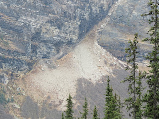
We only saw the scar from a large land slide on a smaller hill at its foot (IMG_1592).
The
view further north was mostly attracted by the majestic Castle Mtn
(IMG_1608).

From the road, we saw a high cliff like a big wall on a castle. On the base of this cliff was the talus it was now fully covered by forest, and this forest was expanding upward on the cliff forming a series of window like feature separated by gullies (IMG_1615).

We had taken some good photos of this mountain from the Castle Junction in 2014 (IMG_2676), it showed the rugged erosion on the wall, but his window like feature was mostly blocked by the tree top and was not seen as clearly.

It also showed clearly that the wall was made up of three layers: the top was Eldon cliff with no layering texture, and then a thin layer of Stephen shale, and finally the Castle cliff with visible layering structure, and which was thicker to provide a strong base to support the upper layers (IMG_1855).

There were many irregular vertical cracks on the top most cliff, and the erosion produced many scars on the face by the broken and falling off slabs (P1070455).

Protection Mtn (2785 m) was north of Castle Mtn separated by a valley.

One photo (IMG_2371) captured the tit like Helena Peak (or Stuart Knob?) between these two mountains. The heights of these two mountains were about the same, but the talus on the Protection Mtn reached much higher in elevation.


I don't have a close-up photos of Pilot Mtn, and only have one taken in 2013 (IMG_1854) and recently (IMG_4843, IMG_4847), and they were all taken from a far distance.

From the road, we saw a high cliff like a big wall on a castle. On the base of this cliff was the talus it was now fully covered by forest, and this forest was expanding upward on the cliff forming a series of window like feature separated by gullies (IMG_1615).

We had taken some good photos of this mountain from the Castle Junction in 2014 (IMG_2676), it showed the rugged erosion on the wall, but his window like feature was mostly blocked by the tree top and was not seen as clearly.

It also showed clearly that the wall was made up of three layers: the top was Eldon cliff with no layering texture, and then a thin layer of Stephen shale, and finally the Castle cliff with visible layering structure, and which was thicker to provide a strong base to support the upper layers (IMG_1855).
There were many irregular vertical cracks on the top most cliff, and the erosion produced many scars on the face by the broken and falling off slabs (P1070455).

Protection Mtn (2785 m) was north of Castle Mtn separated by a valley.

One photo (IMG_2371) captured the tit like Helena Peak (or Stuart Knob?) between these two mountains. The heights of these two mountains were about the same, but the talus on the Protection Mtn reached much higher in elevation.


I don't have a close-up photos of Pilot Mtn, and only have one taken in 2013 (IMG_1854) and recently (IMG_4843, IMG_4847), and they were all taken from a far distance.
We soon turned left (west) into the road to Lake Louise. We had been here several times, but didn't stay long due to the crowded tourists and it was not our destination. This time, Fong had booked a room in Lake Louise Inn, and we had plenty of time to savour the scenery. We turned to Moraine Lake Rd just to check if it was opened. The road was closed, and we had no choice but to turn back to go straight to Lake Louise. We passed the large complex of Deer Lodge where all buildings were log houses. It was also closed. Fong said that probably they were not built for winter occupation.

We were in front of the lake at 11 am, and there were only a scatter of tourists. However, it was very cloudy (IMG_1630), and it prevent us to take a lot of photos. The lake was rectangular in shape with a southwest to northeast orientation. The observation ground was at its eastern end where its outlet Louise Creek was located (IMG_1837).

Judging from the smallness of this creek, the outflow from the lake was never large, that implied that melting water from the glacier was never strong. The lake was bound to its south side by the vertical high cliff of Fairview Mtn (2744 m). The western end of the lake was blocked by the moraine of Lower Victoria Glacier. Beyond this end was the vertical cliff of Mt Vicoria (3464 m). The summits of Mt Whyte (2983 m) and Mt Niblock (2976 m), and the ball shape Big Beehive (2270 m) were also dominated at this end of the lake. Finally, its north side was bound by the forest on the slope of Mt Saint Piran (2649 m) (P1150132, imgp_1829).

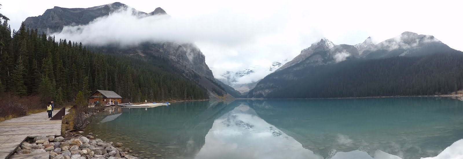
The Lower Victoria Glacier had receded and there was no ice on its previous main path except boulders and rocks on the moraine. Some ice were still visible sticking to the foot of cliff on top of the moraine (IMG_1836).

Further up, Mt Victoria and the upper glacier were hidden behind some low clouds (IMG_1639, IMG_1640).


Fairview
Mtn was the northern terminal of a small range running northeast. To
its south, was a smaller Saddle Mtn (2433 m). This small range looked
like a tadpole. Its tail was terminated at the foot of another ridge
where the following peaks were located: Sheol Mtn (2778 m), Haddo
Peak (3070 m) and Mt Aberdeen (3152 m). An overall view of this
mountain could be seen from the village of Lake Louise. Fairview Mtn
was like an up-side-down bowl with many ridges at its face (IMG_1819,
IMG_1822).


There was a wide 20 degree tilting band on the middle of its slope running from north to south (IMG_1931).

The view from the ground could be divided into two parts: the lower and the upper. The lower part was the tall wall like cliffs around the mountain.

The most spectacular of them was the tall and steep wall facing the lake (IMG_1644). According to Gadd, the rocks belong to Gog Group formation, and was made of quartzites. It was hard and had a red-brown colour.

The top part started from the top of these cliffs, and it had nearly flat face tapered off to the pointy submit (IMG_1751) like the face of a pyramid. There were many gullies running on the faces at the top, and some of them terminated at the opening of cracks on the top of the cliffs. These will be described later in the walk on the Lake Agnes Trail.

One large funnel started from nearly the summit and it went through the cliff of the lower slope (IMG_1842). The layering structure at the top of Fairview Mtn had been completely shaken, broken and crumbled. The rocks appeared in pieces not in blocks, and they looked like being fractured by a big blast of a powerful bomb. The major layering at its base was distinctly visible by the different colour of its compositions. Some snows were seen on its summit.

A perfect shadow of the mountain in the lake could be seen from a trail on the north shore of the lake (IMG_1892).
To
the southwest of Lake Louise was a basin walled by a ridge over 3000
m high delineating the boundary between Alberta and British Columbia.
There were several high mountain peaks on this ridge: Mt Lefroy (3423
m), Mt Victoria (3464 m), Mt Victoria North Peak (3388 m), Collier
Peak (3215 m) and Popes Peak (3163 m). From the observation platform
at the northeast shore of the lake, we could see a section of this
ridge and Mt Victoria, Mt Victoria North Peak, Collier Peak and Popes
Peak (IMG_1981).

There was a U-shape gap on the ridge between the Mt Victoria North Peak and Collier Peak. It was most likely created by the glacier (IMG_1984) and was probably the outlet for the Upper Victoria Glacier.

The rest of the ridge looked very rugged (IMG_1986).


A subsequent photo showed that Popes Peak was very pointy (IMG_1982).
On our continuing trip the next day, I had the opportunity to take a better photo of this peak near the intersection with Hwy 93, but my attention was fully captured by the huge wall probably extended from this peak. Steep cliff under this ridge was covered by snow most of the time. The cliff face was not smooth and had many broken rocks sticking out. Snow falling or sliding from the ridge accumulated behind these rocks and formed a shape like eye drops. These eye drop features covered the whole face of the cliff like a curtain (IMG_1987).

The ridge decreased its elevation south of the summit, and it might have a depression to allow the accumulation of much thicker snows. This depression might also serve as an outlet to let the glacier (Lefroy Glacier?) to flow over the ridge. The peripheral of a large chunk of this thick snow pack had cracked and seemed ready to break off. When this happen, it would be liked a large chunk of glacial ice broken and falling from its main body (IMG_1991).

The cliff didn't go all the way to the foot of the mountain, and terminated on wide rocky table top. This table top was especially large on the northern side of the summit under the U-shape gap. Snow accumulated on it permanently and formed a glacier (IMG_1995, IMG_1999).


I wondered if it was part of the Victoria Glacier. This table top marked the lower boundary of snow. Below it, the slope of this ridge form another cliff all the way to the foot of the ridge. This lower cliff had no snow (IMG_1640).

At the foot of the cliff were all the debris washed down through the glacier channel or cracks in the cliff. The debris seemed had accumulated very high on the foot of the cliff (IMG_1804, IMG_1805).


A closer look from Lake Agnes Trail revealed that the debris was only a thin crust on the surface of the dump. Underneath it, was the remain of the white snow (P1150089).

From the observation ground on the shore of the lake, we could not see other peaks on the ridge of Mt Victoria.

There was a U-shape gap on the ridge between the Mt Victoria North Peak and Collier Peak. It was most likely created by the glacier (IMG_1984) and was probably the outlet for the Upper Victoria Glacier.

The rest of the ridge looked very rugged (IMG_1986).


A subsequent photo showed that Popes Peak was very pointy (IMG_1982).
On our continuing trip the next day, I had the opportunity to take a better photo of this peak near the intersection with Hwy 93, but my attention was fully captured by the huge wall probably extended from this peak. Steep cliff under this ridge was covered by snow most of the time. The cliff face was not smooth and had many broken rocks sticking out. Snow falling or sliding from the ridge accumulated behind these rocks and formed a shape like eye drops. These eye drop features covered the whole face of the cliff like a curtain (IMG_1987).

The ridge decreased its elevation south of the summit, and it might have a depression to allow the accumulation of much thicker snows. This depression might also serve as an outlet to let the glacier (Lefroy Glacier?) to flow over the ridge. The peripheral of a large chunk of this thick snow pack had cracked and seemed ready to break off. When this happen, it would be liked a large chunk of glacial ice broken and falling from its main body (IMG_1991).

The cliff didn't go all the way to the foot of the mountain, and terminated on wide rocky table top. This table top was especially large on the northern side of the summit under the U-shape gap. Snow accumulated on it permanently and formed a glacier (IMG_1995, IMG_1999).


I wondered if it was part of the Victoria Glacier. This table top marked the lower boundary of snow. Below it, the slope of this ridge form another cliff all the way to the foot of the ridge. This lower cliff had no snow (IMG_1640).
At the foot of the cliff were all the debris washed down through the glacier channel or cracks in the cliff. The debris seemed had accumulated very high on the foot of the cliff (IMG_1804, IMG_1805).


A closer look from Lake Agnes Trail revealed that the debris was only a thin crust on the surface of the dump. Underneath it, was the remain of the white snow (P1150089).

From the observation ground on the shore of the lake, we could not see other peaks on the ridge of Mt Victoria.
To
the north of Mt Victoria, and to the east of the high ridge, where Mt
Victoria was located, were two mountains easily seen from the lake
(IMG_1785).

They were Mt Whyte (at left or south) and Mt Niblock. In front of them was the ball-shape Big Beehive. These two mountains looked like the horns of a cattle, and there was a well developed cirque between them (IMG_1916, IMG_1918).


The top of Mt Whyte had a complex facade made of vertically erected, crooked, and extensively carved columns, and had the appearance of an abandoned and disintegrated large Hindu temple. The top of Mt Niblock had a similar structure and texture like that of Mt Whyte with less complexity and they were slanting at different directions. Big Beehive was simply an layered mountain which had been eroded into the shape of a beehive. Its layered rocks were all fractured and crumbled like those seen on the top of Fairview. Some trees grew on its top part of the slope, and it looked like a face which had not been shaved for a week. Its side grew no tree or vegetation to expose clearly its vertical structure.

The horizontal layering structure in Mt Saint Piran could be seen to go all the way to its summit (IMG_1979). Its top was bare and featureless.
We
were encouraged by our achievement yesterday in walking on the
Sulphur Mountain Trail in Banff, and took Fong's suggestion of taking
the Lake Agnes Trail. The trail took 3.5 km and gained an elevation
of 384 m to reach its destination at Lake Agnes Tea House (IMG_1855).

 The trail would then descend to the Plain of Six Glacier in the
moraine of the Lower Victoria Glacier. We walked pass the Fairmont
Chateau Lake Louise, and saw a man hanging on a rope washing the
windows. The scene was very much like what we saw in a spiderman
movie (IMG_1656). On the trail, we met some people, and I saw a
corner of the moraine where the surface had been torn down probably
by land or snow slide, and it revealed that the rocks and other
debris constituted only a thin crust on top of the white snow or ice
underneath. The trail was on a steep slope covered by mature
evergreen trees, and the ground was covered by a thick layer of
mosses like what we had seen on Sulphur Mtn in Banff (P1150119).
However, there was no evidence of sulphur on the ground.
The trail would then descend to the Plain of Six Glacier in the
moraine of the Lower Victoria Glacier. We walked pass the Fairmont
Chateau Lake Louise, and saw a man hanging on a rope washing the
windows. The scene was very much like what we saw in a spiderman
movie (IMG_1656). On the trail, we met some people, and I saw a
corner of the moraine where the surface had been torn down probably
by land or snow slide, and it revealed that the rocks and other
debris constituted only a thin crust on top of the white snow or ice
underneath. The trail was on a steep slope covered by mature
evergreen trees, and the ground was covered by a thick layer of
mosses like what we had seen on Sulphur Mtn in Banff (P1150119).
However, there was no evidence of sulphur on the ground.

The trail was wide and well maintained. Again, we were welcome by the friendly Canada jay. We walked for 2.8 km and gained an elevation of 210 m and reached the first major switch-back in one hour. We walked more distant today but gained lesser elevation. The location of the switch-back probably face a valley, and it had an opening to provide a better view of the lake and the cliff of Fairview Mtn (IMG_1673).

The photo showed that on the southwest corner of its ridge terminating at the lake, there were three talus coming from three separated cracks on the mountain cliff wall. Their surface were all covered by boulders and rocks. The surface of these talus was now covered by scatter trees, a blanket of shrubs and lichen. On the lowest talus, there seemed to be a trail around it. But now it was blocked by boulders (IMG_1672).

From the straight summit, several shallow gullies had scratched a band of forest and plunged to the cliff (IMG_1703).

The slope of these gullies was steep, and they had scrapped all the loose rocks in the gullies and made their bottom clean. The top of one large gully was connected to the bottom of a funnel, and its bottom end was terminated at the opening of a large vertical crack on the cliff. This was probably the major route for transporting materials to the talus below the crack (IMG_1702, IMG_1706).

Closer to the end of the lake where the glacier was located, there was a funnel on the slope of the mountain near its top (IMG_1708).

It might be the beginning of a processing in creating a cirque. No significant tilting in layering on Fairview Mtn and the Big Beehive was seen from this location. We rest for 20 minutes and started to walk back. It took us 40 minutes to return to our starting point.


The trail was wide and well maintained. Again, we were welcome by the friendly Canada jay. We walked for 2.8 km and gained an elevation of 210 m and reached the first major switch-back in one hour. We walked more distant today but gained lesser elevation. The location of the switch-back probably face a valley, and it had an opening to provide a better view of the lake and the cliff of Fairview Mtn (IMG_1673).

The photo showed that on the southwest corner of its ridge terminating at the lake, there were three talus coming from three separated cracks on the mountain cliff wall. Their surface were all covered by boulders and rocks. The surface of these talus was now covered by scatter trees, a blanket of shrubs and lichen. On the lowest talus, there seemed to be a trail around it. But now it was blocked by boulders (IMG_1672).

From the straight summit, several shallow gullies had scratched a band of forest and plunged to the cliff (IMG_1703).

The slope of these gullies was steep, and they had scrapped all the loose rocks in the gullies and made their bottom clean. The top of one large gully was connected to the bottom of a funnel, and its bottom end was terminated at the opening of a large vertical crack on the cliff. This was probably the major route for transporting materials to the talus below the crack (IMG_1702, IMG_1706).


Closer to the end of the lake where the glacier was located, there was a funnel on the slope of the mountain near its top (IMG_1708).

It might be the beginning of a processing in creating a cirque. No significant tilting in layering on Fairview Mtn and the Big Beehive was seen from this location. We rest for 20 minutes and started to walk back. It took us 40 minutes to return to our starting point.
We
went to the tea house inside the Faimont Charteau, but didn't find
anything interested us. We decided to check-in in the hotel. The top
of Fairview Mtn was still under clouds, and we could only see the two
large flat face near the top. The mountain look very massive from its
northern end liked that of Mt Cascade. The inn had several large
3-stories wooden structures with a corridor in the front of its
floor. From the corridor we had the view of Saddle Mtn and Fairview
Mtn (IMG_1734, IMG_1735, IMG_1763).


On the recommendation of the staff in the inn, we went to the cafeteria of a hostel across the street. Mommy ordered a chowder, Fong a sandwich and I ordered a beef chili. I had this dish before but had forgotten about it. And was very disappointed when it was delivered to me. After meals, we walked to the village nearby.
There was a nice and new visitor centre (IMG_1743), but it was opened on Thursday only. Park Canada really cut deep on its operation.

There was a small break in the cloud, and I saw the pyramid shape of the summit of Fairview Mtn. Some snows were scattered on the summit, and on side of the pyramid. The break in the clouds also revealed the peak of Sheol Mtn (2778 m) behind the Saddle Mtn (IMG_1750). We also saw partly the blue colour gigantic Mt Temple (3544 m, IMG_1764, IMG_1817) and the tongue of a glacier flowing down from its summit which was hidden behind clouds.


From the village, we could also see the skii hill (IMG_1745). On our return trip, I had a better photo of this skii hill (IMG_2364). Some breaks in the clouds shined on the hill, and created some bright golden patches.


A magpie was hopping on the sidewalk. It was very tame and allowed me to take many photos of it (IMG_1760). A Filipino tourist found it interesting, and lured it with some foods to take its photos. We had nothing special to do and decided to go back to the lake. This time, we could see the peaks of Fairview Mtn, Mt Whyte, Big Beehive and Mt Nibock. With the aid of the powerful zoom lens, we could see the Lake Agnes Tea House and the Fairview Lookout in the opening of the dense forest on the mountain slopes on both side of the lake.


On the recommendation of the staff in the inn, we went to the cafeteria of a hostel across the street. Mommy ordered a chowder, Fong a sandwich and I ordered a beef chili. I had this dish before but had forgotten about it. And was very disappointed when it was delivered to me. After meals, we walked to the village nearby.
There was a nice and new visitor centre (IMG_1743), but it was opened on Thursday only. Park Canada really cut deep on its operation.

There was a small break in the cloud, and I saw the pyramid shape of the summit of Fairview Mtn. Some snows were scattered on the summit, and on side of the pyramid. The break in the clouds also revealed the peak of Sheol Mtn (2778 m) behind the Saddle Mtn (IMG_1750). We also saw partly the blue colour gigantic Mt Temple (3544 m, IMG_1764, IMG_1817) and the tongue of a glacier flowing down from its summit which was hidden behind clouds.


From the village, we could also see the skii hill (IMG_1745). On our return trip, I had a better photo of this skii hill (IMG_2364). Some breaks in the clouds shined on the hill, and created some bright golden patches.

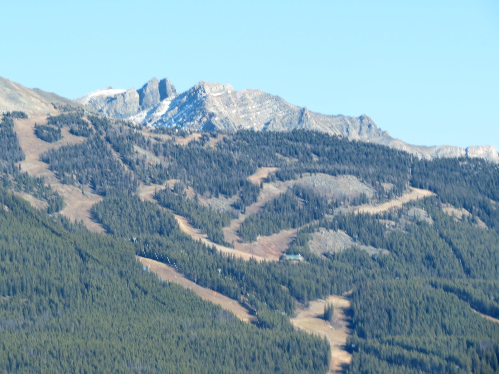

A magpie was hopping on the sidewalk. It was very tame and allowed me to take many photos of it (IMG_1760). A Filipino tourist found it interesting, and lured it with some foods to take its photos. We had nothing special to do and decided to go back to the lake. This time, we could see the peaks of Fairview Mtn, Mt Whyte, Big Beehive and Mt Nibock. With the aid of the powerful zoom lens, we could see the Lake Agnes Tea House and the Fairview Lookout in the opening of the dense forest on the mountain slopes on both side of the lake.


We saw thick ice on the Upper Victoria Glacier. The ice on top of cliffs showed a significant layering structure. Furthermore, the layer was not in one piece in a perfect horizontal orientation, but somewhat bulking in the middle. And had the appearance of the piling of snow blocks for building an igloo (IMG_1795, IMG_1994, IMG_2023).
At a distant, we saw a lonely beautiful estern grebe floating on the water closer to the south side of the lake (IMG_1889). It had a long and straight white neck liked a swan, the top half of its head was black, and its bill was yellow. Its body was grayish blue. We then went back to the hotel. There were swimming pool in the inn, but we were too lazy to go, and only Fong did.

Tuesday,
2015-10-20
It
was a nice day with blue sky. We could see very clearly many majestic
mountains around Lake Louise area from the inn and the village at
different viewing angle from that in the lake. I saw a broad flat
peak from the inn. It was partly covered by broken clouds, and in
front of the peak was a large cirque. I guessed that it was the ridge
running north from the peak of Mt Niblock. I saw Mt Whyte, the big
cirque between it and Mt Niblock and the Big Beehive shined by the
bright early sun. I also saw the top of Mt Victoria, and found that
there was rocky outcrop standing up at its southern end. Snows were
accumulating behind the projections of rocks on the cliff and had the
shape like eye drops. A thick ice and snow were seen on top of a
cliff at the base of high cliff immediately under the summit. The
summit of Mt Temple as well the glacier, and the two adjacent peaks
and the Small Temple Mtn to its east were all clearly visible. The
summit of Fairview Mtn had pyramid shape, and the face of the pyramid
looked smooth from a far distance. Further down, the slope of the
mountain became very complex, and was filled with vertical ridges,
gullies and cliffs. The talus at the base of the mountain was covered
by dense forest. To the east, we had a clear view of the skii hill
and saw the gondola and snow fences on the hill.
The
inn didn't include breakfast, and we walked to a bakery in the
village to have it. There were two old men sitting on the next table,
and Fong engaged in some conversations with them. We met again one of
them when we were walking back to the inn. He was a naturalist and
knew a lot about the bird in the area and their migration. He
suggested that we went to visit Emerald Lake in Yoho National Park
near Field. He said that the local preferred to go there because
there were less crowded than Lake Louise. I was very happy of this
choice because on our last bus trip, I could only take photos from
Vancouver to Field, and then it was too dark to take any. Therefore,
I was happy to fill this gap, and furthermore, this would be our
first trip to Emerald Lake. Not long after we turned north from Lake
Louise, a towering cliff at far north near the intersection with Hwy
93 captured our attention. It was Mt Hector (IMG_2045), and it was on
east of Hwy 93 not far from the intersection.

We could see the pointy and ragged cliff liked a cathedral in a ghost story and behind it was a butte standing on snow covered base like a ball point tip. I would make sure that I would capture a better photo of this mountain on my trip to Columbia Ice Field.

As we were approaching the intersection, A huge cliff wall blocked our view (IMG_2059). There were three peaks to its left (south). The first one was probably the farthest, and it appeared as a ball point tip cover in snow. Next was a massive and dull wedge shape with distinct horizontally layered peak. It was lightly powdered by snow. The last one was a pointy and rugged peak. According to the map, there were three steep and long long cliff like wall running from south to north in this area west of the highway. Two of them were extended from Popes Peak. The closest one ran northeast halfway to west of Mt Whyte and then turn north with a short Z-shape turn until it hit Hwy 1. It was a part of the border between Alberta and British Columbia. Its elevation was about 2500 m. The other ridge had a look of a boomerang. Its southern arm ran northwest from Popes until it reached Narao Peak (2974 m); its northern arm ran northward from this peak up to the same latitude as the previous ridge started its Z-shape turn. There were two cirques at it foot. The last one was the steep ridge where Mt Daly (3148 m) was located at its northern terminal. This ridge was the northern extension of the first ridge that started from Popes Peak after it crossed Hwy 1. This ridge was west of Waputik Peak (2737 m) and was in agreement of that shown in photo (IMG_2061).

I
assumed that what I had captured in the photo was this ridge where Mt
Daly was located. The first peak (having the shape of a ball
point tip) shown on photo (IMG_2059) was probably Mt Balfour (3272
m), next was (the massive wedge shape) was Mt Niles (2972 m), and the
last one (pointy and rugged) was Michael Peak (2696 m). The wall
could be divided into several levels like sandwiches according to its
snow cover and the layering. The top one was very steep, full of
vertical crack and no snow cover. It had one very large scar and some
smaller ones created by rock slides. This level tapered off toward
its southern end, and terminated at 2/3 of the length of the whole
wall. The next level wall had some gentle slope to allow the
accumulation of talus and snow from the higher layer. This was
especially significant below the scars on the top level. The next
level looked similar to the top but rougher in appearance. On it
southern (left) end, there were many deep cracks or gullies running
down from the second level wall. It had a thick layer of lighter
colour rocks at it base. The next level was like the short tutu skirt
worm by ballerinas. Some of it had been covered in thick snow fed by
the cracks on the upper level. Below this level was a large well
developed cirque (IMG_2057).


We
also saw the dark colour Waputik Peak in front of us near the
intersection. It was on the west side of Hwy 93 separating from Mt
Hector by the wide U-shape Bow River Valley.


We saw a butte shape
peak with clear horizontal layers surround by a well developed
cirque, but I couldn't identify or guessed its identity (IMG_2066). I
assumed that it was Mt Wapta (2778 m). It had a butte as its peak and
was similar to that of Mt Bourgeau. The summit had suffered from rock
slides which had eroded its face, and left a ridge at the middle.

Soon the highway left the broad Bow River Valley and turned west into the narrow Kicking Horse Pass. The first thing that came into view was that unmistakably Cathedral Crags () between Cathedral Mtn (3189 m) and Mt Stephen (3199 m) (IMG_2082). As the name implied, Cathedral Crags was a pile of rocky, rugged and steep cliff standing on its layered base.


We stopped at the end of a long queue. Mt Field was in front of us, and we could see a big landslide or avalanche had taken a big chunk from the ridge behind (north) the peak and created a big strip of bare avalanche gulley (IMG_2097, IMG_2100).
Park Canada was blasting a road side rock cliff near Sherbrooke Creek to stabilize the slope (IMG_2109, IMG_2336).


After we were through of the construction zone, we were on a pass between Mt Ogden and Cathedral Mtn over the Spiral Tunnels built by Canadian Pacific Railway to overcome the problem of having to ascend 330 m over a short distant of 16 km. After failing in the simpler and less expensive solution of running the train at a steep 4.4% slope instead of the 2.2%, the company decided to build this tunnel. The track coming from east entered a tunnel dug under Cathedral Mtn for 1 km, turned around in a circle and came underneath the entering tack after loosing 15 m in elevation. It then descended on the valley, crossed the Kicking Horse River and entered Mt Ogden and do another similar circular turn to loose another 15 m in elevation. In total, they managed to reduce the slope to the satisfactory grade of 2.2%.

On our previous trip,we stopped at an observation platform to see the two holes, entrance and exit, of the tunnel on the slope of Mt Ogden (IMG_1804). I remember of seeing a long train part of it was entering the tunnel and the other part was leaving but I didn't have any photo of it.
Heavy
fog was moving in from the west and spilled over into Yoho River
Valley between Mt Ogden and Mt Wapta. Lake Wapta, the source of
Kicking Horse River (Yoho River) was almost dried, and the sky over
it was completely covered by fogs and clouds (IMG_2126).

The boulder filled river bed became many times wider and squeezed to its normal size at Field, and then expanded again liked a squash. At the end of this wide river bed, the river turned west on its normal size, and we turned right into Emerald Lake Rd just slightly before the river made the turn. We stopped to see a natural wonder: The Natural Bridge (IMG_2133, IMG_2138, IMG_2134).


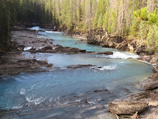
The river had cut through a crack in a big rock blocking its course. The difference in water level was about 4 m, and the water rushed through this crack like a small water falls. The river bed was mostly shale. Visitor was not allow to get close to the big rock, and could only appreciate the wonder from a hanging bridge.

The boulder filled river bed became many times wider and squeezed to its normal size at Field, and then expanded again liked a squash. At the end of this wide river bed, the river turned west on its normal size, and we turned right into Emerald Lake Rd just slightly before the river made the turn. We stopped to see a natural wonder: The Natural Bridge (IMG_2133, IMG_2138, IMG_2134).


The river had cut through a crack in a big rock blocking its course. The difference in water level was about 4 m, and the water rushed through this crack like a small water falls. The river bed was mostly shale. Visitor was not allow to get close to the big rock, and could only appreciate the wonder from a hanging bridge.
We
saw several tall mountain peaks above the top of the forest along the
road. Emerald Lake had a shape like a pear sitting a the bottom of a
basin like a toilet hole on the ground surrounded on three sides by
broken high mountain ridges: on the west was the ridge where the
following mountains or peaks were found: Mt Carnavon (3040 m) and Mt
Marpole (). In front (east) of this ridge, there were Emerald Peak
(2566 m) and Top Hat Peak (2590 m). On the north, there was the ridge
of President Range where the following peaks were found: The
President (3138 m) and the Vice President (3066 m). The same ridge
was then turn southeast and terminated at Michael Peak (2696 m) at
north of the lake. The ridge then descended into a saddle point at an
elevation of 1600 m, and then joined another ridge where the
following mountains were found: Wapta Mtn (2778 m) and Mt Field (2623
m). And finally, the ridge of Mt Burgess (2599 m) finished the
enclosure on the south, and left an opening on northwest corner to
drain the lake water into Emerald River.
The sky was mostly clear
with some scattered thin cloud when we reached the end of the road.
After parking the car, we walked across a small bridge to Emerald
Lodge which were located on a narrow peninsula. The lodge consisted
of many separated wooden buildings built on the peninsula. The most
prominent view at this bridge was the summit of the wedge shape
President and the pointy Michael Peak (IMG_2168).

The bright sun shine was behind Mt Burgess and we could only see its shadow. The layering on the President indicated a slight tilting angle, however, its vertical cracks were more prominent. The colour and texture of the rock were similar to that of the Cascade Mtn. The west side of the summit was rugged steep and tall cliff, and its east side tilted gently eastward at an angle of 20 degrees till it was broken by a steep but not very tall cliff. Talus started from about half way of the steep slope of the mountain, and its top delineated the tree line. It was broken by several long gullies running all the way to the foot of the mountain. The texture and colour of the east end of this mountain were more complex, and the scars were mostly the result of broken off slabs. The cliffs were steeper. The top of the talus on this end was only half the height of that on the other end.

The bright sun shine was behind Mt Burgess and we could only see its shadow. The layering on the President indicated a slight tilting angle, however, its vertical cracks were more prominent. The colour and texture of the rock were similar to that of the Cascade Mtn. The west side of the summit was rugged steep and tall cliff, and its east side tilted gently eastward at an angle of 20 degrees till it was broken by a steep but not very tall cliff. Talus started from about half way of the steep slope of the mountain, and its top delineated the tree line. It was broken by several long gullies running all the way to the foot of the mountain. The texture and colour of the east end of this mountain were more complex, and the scars were mostly the result of broken off slabs. The cliffs were steeper. The top of the talus on this end was only half the height of that on the other end.


The view of Michael Peak was also clearer (IMG_2180, IMG_2200).


The darker colour rocks scrambled on its pointy peak looked like a piece of sculpture in a Hindu temple. Below the summit, there was a ramp tilting at 30 degrees to the west. It collected boulders, rocks and other debris eroded from above and then passed them on to the slope below.

We also had a good view of Emerald Peak and its avalanche gully from this side of the lake (IMG_2195). The peak was rather round and flat. Erosion had produced some low cliff below the summit. The bare slope above the tree line had been scrubbed clean by an avalanche, and the trees on the wide avalanche gully had been completely removed, and young trees had started to grow like new hair after shaving.

There was a darker and round rock outcrop in front of the summit on the east edge of the avalanche (IMG_2198). It looked like a fort guiding the ascend to the summit. We struggled on the muddy trail for half an hour, and Fong realized that we would not be able to do very far on this condition and suggested that we turned back.

Since we were at the southwestern end of the lake, we had a complete view of Wapta Mtn (IMG_2202) as well as the summit of Mt Field at the right end of the ridge.

The mountain had a butte summit covered with a thin layer of snow. Half of the center of this butte had been chopped away and left a large gap. The wall of this butte was very rugged and was full of vertical cracks especially toward its south end where erosion had created many sharp pinnacles like what were found in a badland. The peak was near the southern end of the butte, and it looked like a mole on the flat top of the butte (IMG_2203).

The tree line almost reached the base of the butte. Another photo (IMG_2226, IMG_2227) showed a clearer view of this summit.


It was flat with a very gentle slope like the sharp edge of a wedge. It had a very steep and rugged slope as it plunged down abruptly to the Kicking Horse Pass below. At the base of this wedge shape summit was a dark colour thick band running in parallel to the edge of the summit. This band disappeared in the north end of the summit among a jumble of rugged rocks forming a low cliff at the north end of the summit. Further north was a big drop on the top of the ridge probably created by a giant avalanche. It appeared that the ridge connecting Mt Field and Wapta Mtn was originally covered by a softer layer of rocks. This layer was gradually eroded by avalanches to form its present shape. The summit of Mt Field above the dark colour band was probably the remains of this soft layer. This could be seen at closer distant from Hwy 1 near Sherbrooke Creek as shown in the previous photos. There was one very large gap on the top of the ridge at halfway between Wapta Mtn and Mt Field. This gap had the shape of an avalanche gully. At the south side of this gully and near its bottom was the famous Walcott Quarry where he made the discovery of soft body fossils preserved in the Burgess Shale.

The other photo (IMG_2214) clearly showed the saddle point connecting the slopes of Michael Peak at the north (left) and the slope of Wapta Mtn on the south. The same photo also showed two minor features behind the saddle: one was the top of Mt Niles (2972 m) which had a flat wedge shape peak and a high and steep cliff at the summit, and the other was a small fraction of an interesting looking ridge. The ridge ran from northwest to southeast for a length of 3 km on the west side Yoho River Valley. It was very straight. Its east side was flat and steep, but its other side was full of vertical folds from the top to the bottom like a paper fan.


The viewed of Mt Burgess was clearer now but was still affected by its own shadow (IMG_2204, IMG_2206). This mountain was featured on the ten dollar bill issued between 1954 to 1971, and therefore this mountain was also known as the Ten Dollar Mountain. The mountain had the shape of a ghost mountain in mystery books. It was very rugged and steep, and had a big and deep cut at the middle. This cut split the summit into two: the north (left) was called Walcott Peak (2575 m) in memory of the famous scientist who discovered the Burgess Shale fossils in the nearby Burgess Pass, and the pointy peak on the other side of the cut was the Burgess Peak (2599 m).
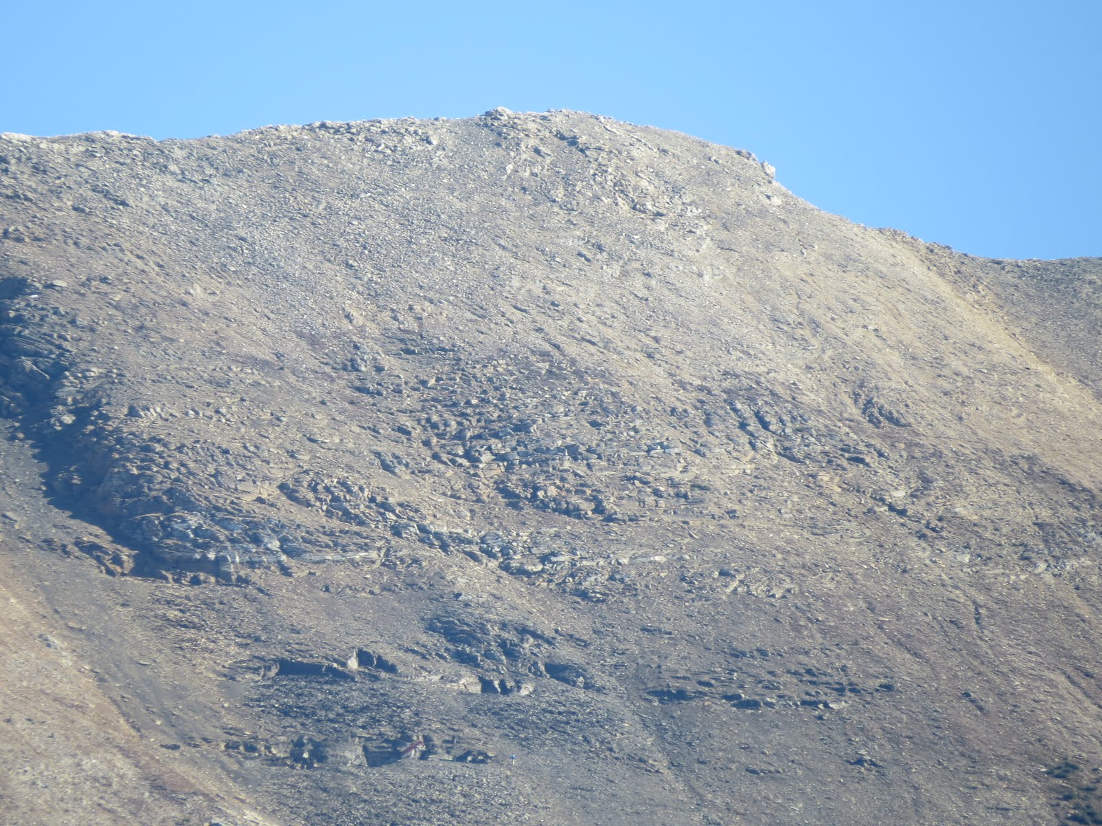
Further down the trail was an observation platform with several explanatory notes about Burgess Shale and Walcott Quarry. In some photos taken with 50x zoom lens, I could see people working in the quarry (bottom lefter corner in IMG_2218).

Not far down the trail, we reached the tail end of Emerald Avalanche. The avalanche probably didn't happen regularly every year, and new trees had started to grow in the gully (IMG_2245). The same photo probably also showed Top Hat Peak behind Emerald Peak.
We
left Emerald Lake at 1 pm, and had a clearer view of the peaks of
Burgess Mtn from the road (IMG_2263).

It was really very rugged had many pinnacles.

From the road, we also saw the summit of Mt Dennis in Field (IMG_2275). It was steep and had some similarity to Heart Mtn with several scarfs wrapping around the neck. There seemed to be a fault running all the way from the peak to the foot of the mountain, and all the bands of layers were terminated at the edge of this fault.

The sky was now clear and blue, and we had a good view of Mt Stephen and Mt Field when we joined Hwy 1 again on our return trip back to Calgary (IMG_2282). A long freight train was rolling at the foot of Mt Stephen. The mountain was like a cup cake with snow sprinkled at its top.


The top half of the mountain was steep and rugged with many bands of horizontal layers with different colour and textures (IMG_2886, IMG_1772). The lower half was mostly talus and was like a skirt with very gentle slope. It was covered by dense forest broken by avalanche gullies.

The slope facing the pass was dominated by a smooth large rock outcrop (IMG_1786).

At its foot, we could see the opening for the Spirral Tunnels, and to the east of this opening was a large avalanche shelter (IMG_2325). Above the shelter was the prominent view of the famous Cathedral Mtn and Cathedral Crags. The above photo was the best photo I had about Cathedral Mtn showing a large and long traditional cathedral with a high roof over the crossing. The photo also shown a white band near the top on Cathedral Crags as well as on Cathedral Mtn. According to Gadd, this white band was made of pure dolostone.

The other side of the pass was Mt Field. The wedge shape summit and the thick and dark colour band below the edge of the wedge were clearly visible from the road (IMG_2285).

I was interested in this dark colour band and looked again in some photos taken from the east side of this mountain, and photo (IMG_2099) confirmed that this band was also visible from this side. The cliff on the southern end of the summit was not very high, and it terminated at the gentler slope below it. The slope was mostly covered by dense forest, but there were. many scars produced by steep cliffs.

We turned into the town of Field, and saw a beautiful house whch was probably the residence of a senior railway employee (IMG_2298).
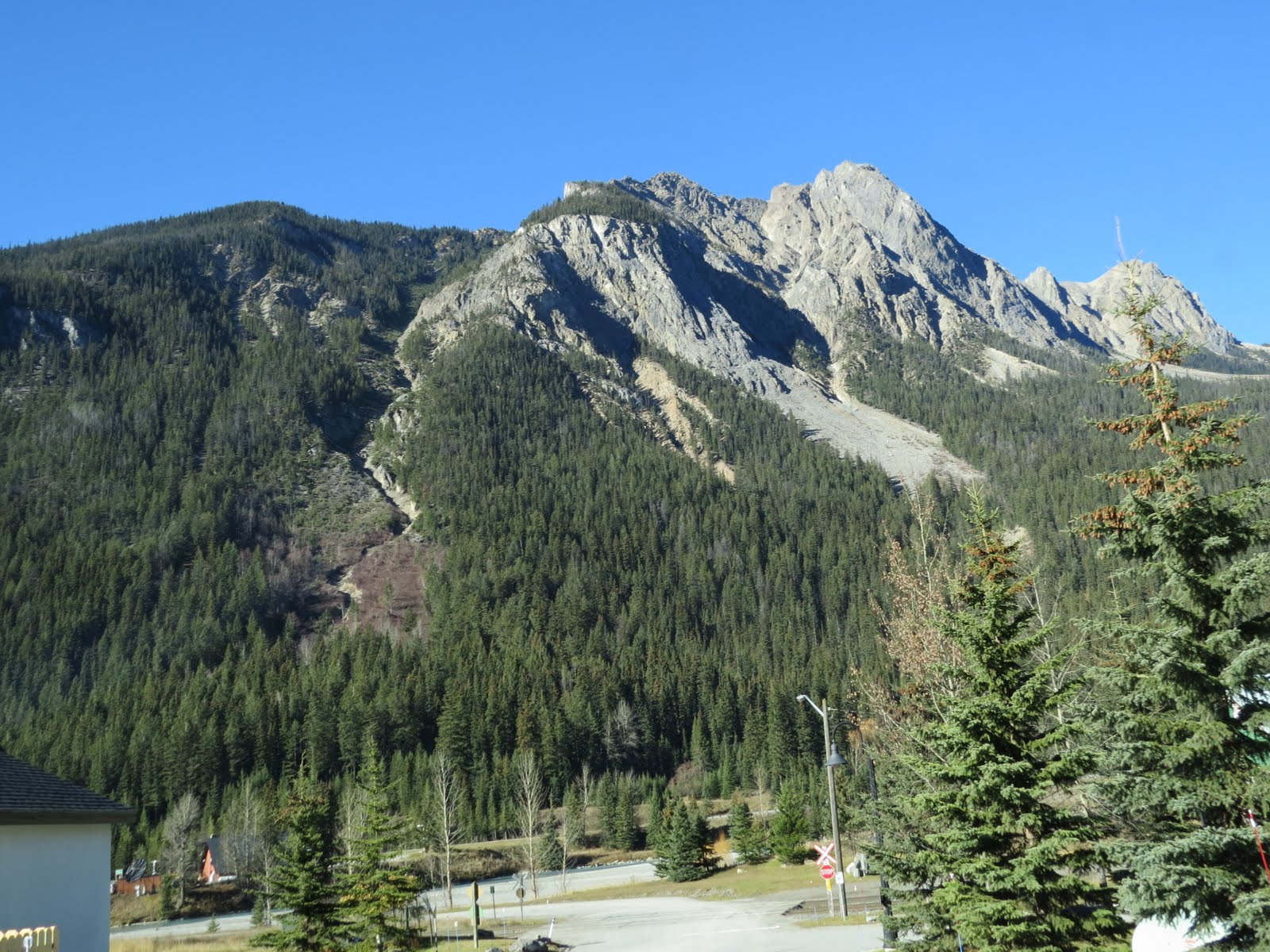

We also saw a different view of Mt Dennis from its northern side. The bare rocky view of the mountain could only applied to its steep and pinnacled peak, but the rest was covered in dense forest. Moreover, this peak seemed to lean on the mountain and the two were separated by a deep zigzag gully running from the top to the bottom. I wondered if this was another major fault running through the mountain (IMG_2305, IMG_2311).

After leaving the town and back to the highway, we saw the Cathedral Crags and then the western slope of Mt Ogden (IMG_2330). The slope was very gentle and mostly covered with dense forest broken in a few places by gullies. The top was bare, and there seemed to be two summits: one was a butte and one was pointy. Two large funnels had been formed on the top terminated at cracks on the top of light blue colour cliffs. There was a large light blue colour scar on the slope, and beside it stood several large slabs of rocks of the same colour. Avalanches seemed have scrubbed the top clean of any debris.


After passing the construct zone near Sherbrooke Creek, we saw the Narao Peak and its nearly straight north running ridge that had been described previously. However, this was the first time that we saw the peak (IMG_2340, IMG_2344). It was thinly covered by snow. Layering was clearly shown under the summit and they tilted north at 30degrees. The remaining slope was mostly covered by talus. The layering only appeared in a small section of the ridge near the summit, the remaining was smooth and had no texture. There was a cut on the summit and made it looked like a cleft lip and produced two peaks. A big funnel below the western peak terminated in a deep gully running all the way to the foot of the mountain.

Popes Peak was at the southeast of Narao Peak, and photo (IMG_2348) showed this wedge shape peak. Its west part was flat and covered by thick snow. The rest of the steep slope was sprinkled with thin snow.

Next we saw a large cirque under a tall mountain (IMG_2358). The mountain stood by itself and supposed to be easy to identify. Furthermore, its top was covered thinly by snow which implied that it was tall. Its peak was round like a hump. The ridge to its west had a large U-shape gap. The ridge terminated in a high cliff in the shape of 4 giant columns standing on triangular shape base made of layered rocks. The whole thing liked the Great Sphinx of Giza. After some scrutinized on map, I thought that it was Mt Saint Piran.